Automatic Area Takeoff
Automatic area takeoff helps you measure suitable shaded regions on a PDF without placing every point by hand. Zip Takeoff's Smart Area tool suggests a boundary for you to review and accept. The accepted area can calculate your attached material quantities and stay useful when the work changes.
No credit card required.
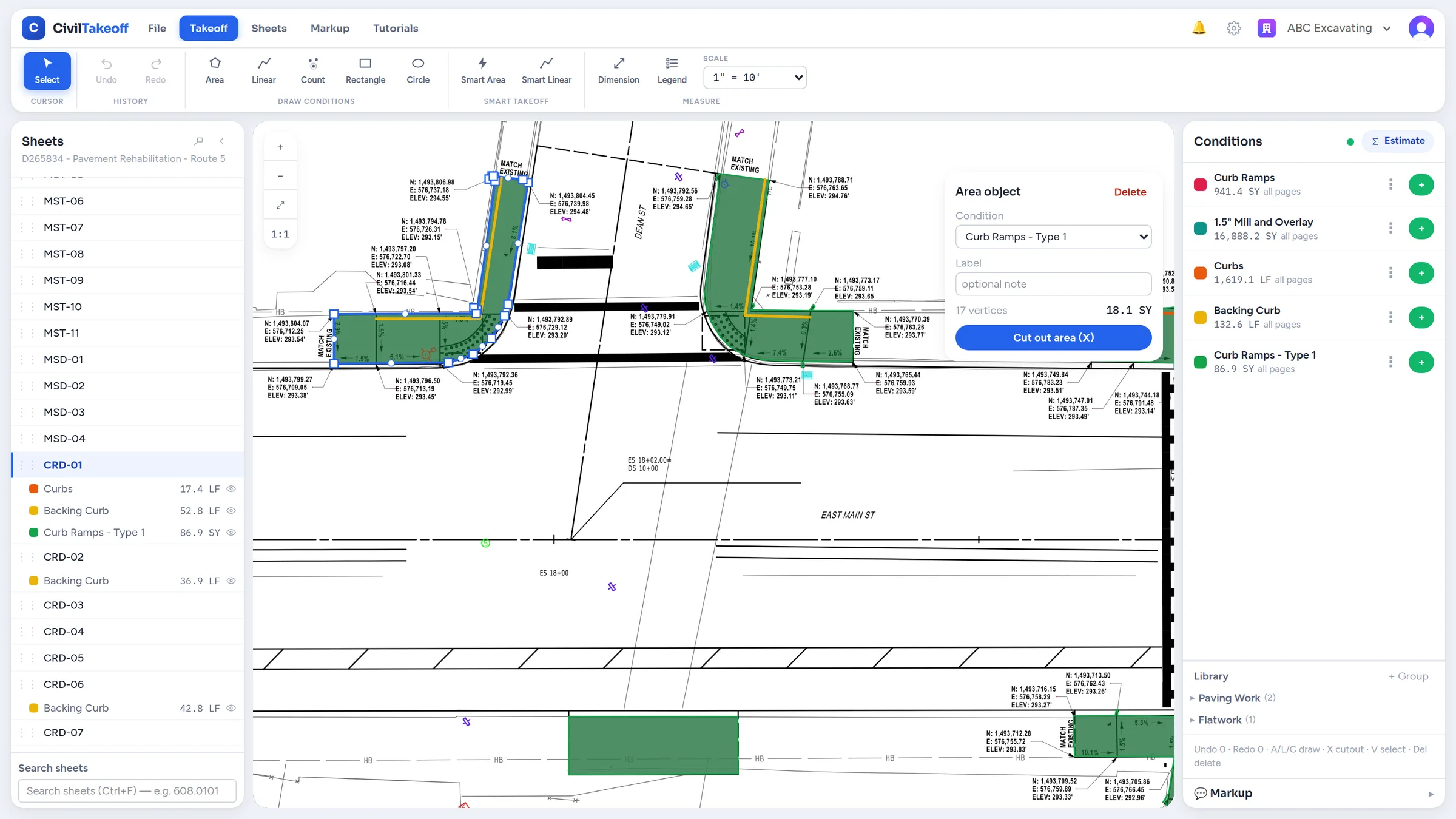
Start with the boundary already in the drawing
On a supported vector PDF, click inside a hatched or shaded region with Smart Area. Zip Takeoff uses the drawing's paths and fills to suggest the area. Check it against the plan and hatch legend, then accept the takeoff you want. Suggestions do not contribute to your quantities until you accept them.
You can adjust the resulting points and cut out islands or other exclusions. The benefit is fewer points to place manually on suitable drawings, with the same editing control you have over an area drawn by hand. Confirm the sheet scale before you start so the outline produces the right quantity.
Get help with plotted lines, too
Smart Linear brings the same idea to linework. Select a plotted line, review the matching suggestions, and keep the runs that belong in your takeoff. Use it for suitable lines on a vector drawing, then check the endpoints and scope.
You can use smart and manual tools on the same job. Trace a section manually when the drawing doesn't offer a useful suggestion, and place counts yourself for structures or other items. You choose the tool that fits each part of the sheet.
Make each accepted area do more than one job
A measured pavement footprint can supply surface area, base volume, and asphalt tonnage. Attach those material or bid items to its measurement group, called a condition in the app, and enter the thicknesses and density settings you need. Accepted areas then contribute to the connected totals.
That gives you a reason to use smart tools beyond getting an outline onto the screen. You can move from drawing to material quantities in the same workspace, with Excel available as an export when you need it.
Example: keep the footprint when the treatment changes
A paving plan separates standard-duty asphalt, heavy-duty asphalt, and concrete pads. Put each treatment in its own measurement group and attach the appropriate items. Select the supported regions, review them, and accept them into those groups.
If an addendum changes one footprint to heavy-duty asphalt, move its existing area to that group. The material quantities recalculate using the destination's settings. If only part changes, split an area without cutouts and reassign the revised portion. You keep the useful measurement instead of starting that footprint again.
Try the tools with guidance beside you
The in-app tutorials cover Smart Area, Smart Linear, reshaping, and material quantities. Follow a walkthrough on a plan you know, check what the tool selects, and see how an accepted measurement contributes to the bid. It's a practical way to judge the software on the drawings you actually receive.
Which drawings work with smart tools?
Smart Area and Smart Linear require usable vector geometry. Scanned PDFs and satellite images use manual measurement tools. Check boundaries around text, gaps, adjoining treatments, and islands. Splitting currently works on areas without cutouts.